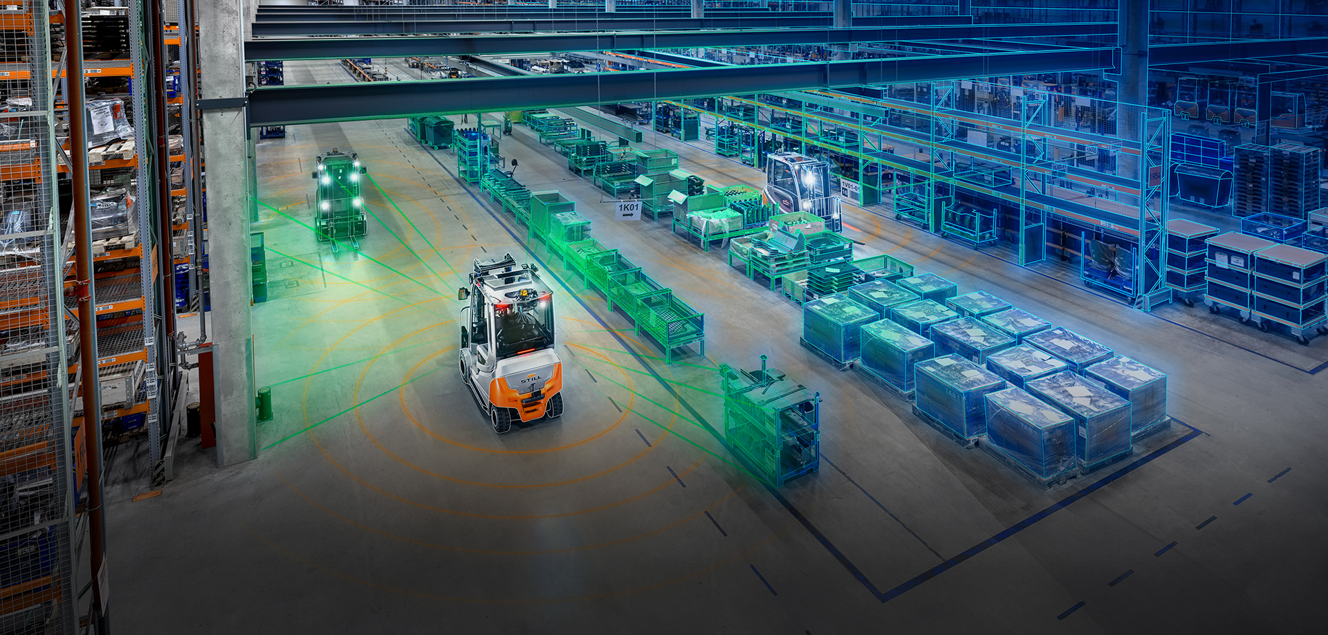
Automated guided vehicles are already being used on a large scale in warehouses and production facilities today. With modern sensor technology such as laser scanners and cameras, they find their way safely through racks, production lines, and warehouses. In the process, they continuously generate a considerable amount of data about the environment in which they move. However, this data is usually not yet systematically processed and lies fallow. What if the full potential of these bits and bytes could be exploited?
"In the international research project ARIBIC we have worked with universities and partners like Google to develop the AI platform of the future," says Ching Pong Quek, Chief Technology Officer of the KION Group. "This technology can be described as Google Maps for Intralogistics allowing the real time localisation of all goods and forklift trucks in a warehouse to become reality."
The Google Maps for Intralogistics
Systematic data processing is precisely where the ARIBIC digitization project implemented by the STILL, a KION Group subsidiary supplying industrial trucks and related services, comes in. The data collected by the sensors on the vehicles are used to create high-quality, high-resolution 3D maps of warehouses or production facilities. A digital twin of the environment is created, thus enabling relevant information to be displayed and shared in real time. “Today, many industrial companies apply so-called post-digitization of their production environments and warehouses. However, this only captures a snapshot,” adds Dr. Joachim Tödter, Senior Director Technology & Innovation at the KION Group.


